Drone Communication MAVLink: The Lingua Franca of Drone Communication Codemonk's recent exploration around vegetation analysis and the autonomous capabilities developed around a custom build quadcopter, we try and understand the kind of value that MAVLink provides to pilots, ground control units/stations, and mission planners alike.
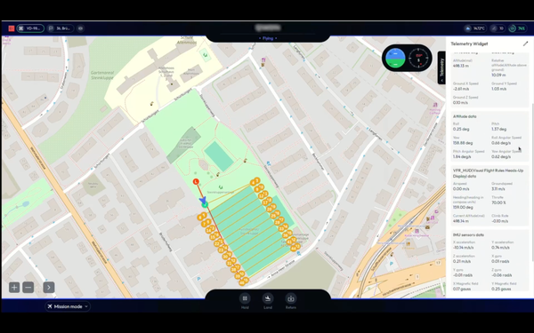
Crop Monitoring Featured Vegetation Analysis and Crop Monitoring Using Autonomous Drone Surveillance Codemonk showcases the basic steps needed to configure autonomous flight for surveillance and monitoring over a predefined area from a ground control station located 2KMs away from the vegetation to be surveilled using a rudimentary quadcopter with 4k 60FPS video recording capabilities.